
Unveiling Hidden Empires: Modern Archaeology’s Thrilling Discoveries of Ancient Civilizations
For centuries, the earth has held its secrets close, concealing the remnants of once-mighty empires beneath layers of soil, jungle, and ocean. The allure of lost worlds – cities swallowed by sand, temples reclaimed by forest, and ports submerged by the sea – has captivated humanity for generations. We’ve often imagined intrepid explorers hacking through dense jungles or diving into the abyss, stumbling upon forgotten treasures. While that romantic image still holds a kernel of truth, the reality of modern archaeology is far more sophisticated, leveraging cutting-edge technology to perform archaeological discoveries on a scale previously unimaginable.
Today, archaeologists aren’t just digging; they’re seeing through the earth itself, mapping vast hidden empires from the sky, and even peering into the ocean’s depths with incredible precision. These revolutionary techniques are not only unearthing new sites but also radically transforming our understanding of well-known ancient civilizations. Imagine uncovering entire cities without moving a single spade of dirt, or mapping a submerged landscape untouched for millennia. This isn’t science fiction; it’s the daily reality for archaeologists equipped with lidar, ground-penetrating radar, sonar, and artificial intelligence. This article will take you on an exhilarating journey through some of the most profound modern archaeological discoveries, revealing how technology is helping us rewrite the history books and bring long-lost worlds back into the light. Get ready to explore the unseen, the forgotten, and the truly extraordinary.

The Quest for the Lost: Why Ancient Civilizations Remain Hidden
Before we delve into the exciting tools of modern archaeology, it’s worth pondering why so many ancient civilizations have remained hidden empires for so long. The reasons are as varied as the cultures themselves, often involving a complex interplay of natural processes and human history.
Natural forces are powerful architects of concealment. Over millennia, dense jungles can reclaim vast urban centers, their structures collapsing and being swallowed by vegetation. Sedimentation from floods and wind can bury entire cities under meters of earth, as seen in many Mesopotamian sites. Volcanic eruptions, while catastrophic, also act as time capsules, perfectly preserving cities like Pompeii and Herculaneum under layers of ash. The relentless march of coastlines, driven by sea-level changes and erosion, has submerged countless ancient ports and settlements.
Beyond nature, human factors also contribute to concealment. Political upheavals, invasions, or economic decline could lead to the abandonment of cities, allowing them to fall into ruin and fade from collective memory. Sometimes, cultures deliberately erased the presence of predecessors, building new cities atop older ones, effectively burying their history. The sheer remoteness of some locations, combined with a lack of written records or oral traditions, meant that many civilizations simply vanished from the historical narrative.
The Earth is a vast archive, but one that requires sophisticated keys to unlock its most profound secrets.
For centuries, discovery relied on chance finds, anecdotal evidence, or painstaking manual excavation. While these methods brought incredible treasures to light, they were slow, labor-intensive, and often missed the bigger picture. This is where modern archaeology steps in, offering those “keys” to unlock the earth’s hidden archives with unprecedented efficiency and insight.
Eyes in the Sky: How Satellite Imagery and Lidar Revolutionize Discovery
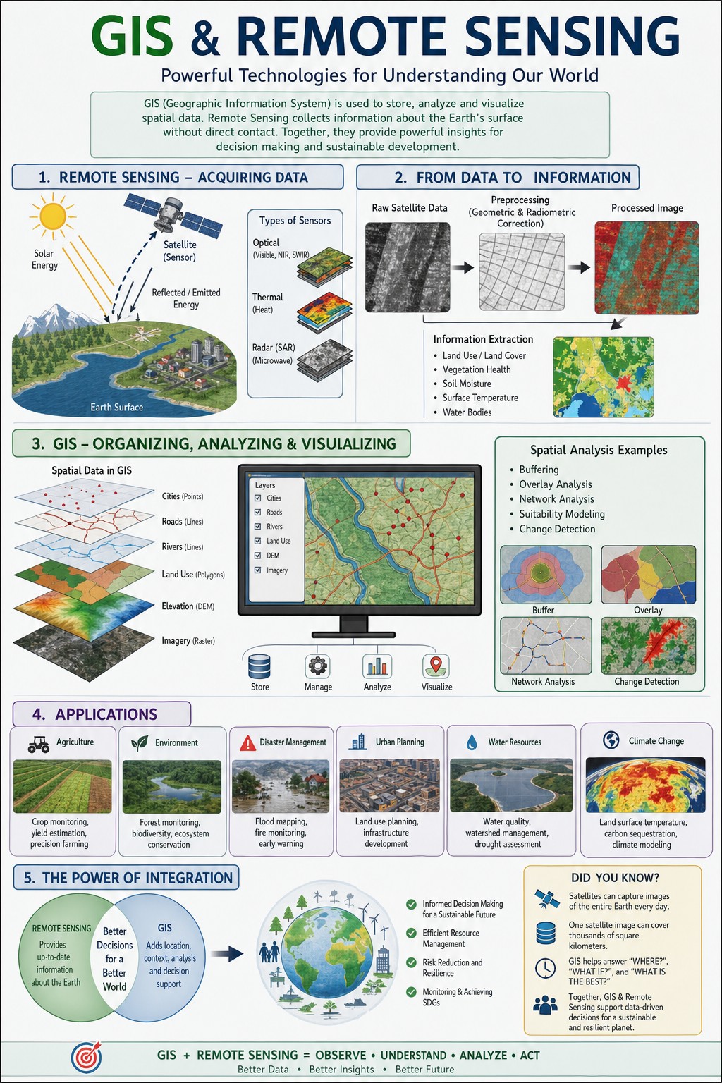
One of the most transformative advancements in modern archaeology has been the ability to see the earth from above. This aerial perspective, initially provided by simple photography, has evolved into highly sophisticated remote sensing techniques that can peer through dense jungle canopies and even map subtle changes in terrain invisible to the naked eye.
Lidar: Laser Vision Through the Jungle
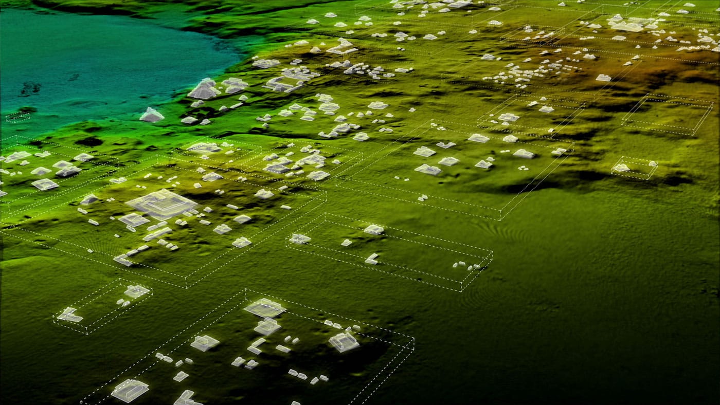
Perhaps the most celebrated of these technologies is Lidar (Light Detection and Ranging). Mounted on aircraft or drones, Lidar instruments emit millions of laser pulses per second. These pulses penetrate gaps in vegetation, bounce off the ground, and return to the sensor, creating an incredibly detailed 3D topographical map of the terrain below. The magic of Lidar is its ability to digitally strip away the jungle, revealing the hidden structures and modifications made by ancient civilizations.
Case Study: The Maya Lowlands of Guatemala
For decades, archaeologists believed that Maya cities in the Petén Basin of Guatemala were relatively isolated settlements surrounded by vast tracts of forest. Traditional ground surveys were slow and arduous, covering only small areas. However, a groundbreaking Lidar survey conducted by the PACUNAM Foundation in 2018 revealed an astonishing truth: the Maya lowlands were home to an interconnected megalopolis.
- Discovery: The survey uncovered over 60,000 previously unknown structures, including houses, defensive fortifications, raised causeways, and elaborate agricultural terracing.
- Impact: This massive archaeological discovery challenged the long-held notion of a sparsely populated Maya landscape, suggesting a population density far greater than previously estimated – possibly millions more people than historians had thought.
- Rewriting History: The findings indicated that the Maya engineered their environment on an immense scale, creating a highly organized and integrated society. It’s a prime example of how modern archaeology is literally redrawing the map of hidden empires.
- Discovery: In regions like Acre, Brazil, satellites have helped identify hundreds of large geometric earthworks, known as geoglyphs, carved into the landscape centuries ago. These aren’t just isolated symbols; they represent complex patterns of settlement and possibly ceremonial spaces.
- Beyond the Geoglyphs: Further north, in the Llanos de Moxos region of Bolivia, satellite data has pointed to vast networks of raised fields, canals, and mound cities, indicating large-scale, pre-Columbian agricultural societies.
- Shifting Paradigms: These archaeological discoveries are dismantling the myth of the “noble savage” in the Amazon, demonstrating that large, complex societies thrived there, managing their environment sustainably for centuries. It’s a powerful testament to the ingenuity of these hidden empires.
- Discovery: In several locations across the UK and Italy, GPR surveys have revealed the intricate street plans of Roman towns, the foundations of elaborate villas, and even buried mosaics, all without excavation. For example, the lost Roman town of Falerii Novi in Italy was mapped in its entirety using GPR, revealing temples, a market, and a bath complex.
- Preservation and Planning: This non-invasive approach is crucial for heritage preservation, allowing archaeologists to understand the full extent of a site before making decisions about excavation or development. It provides a comprehensive blueprint of these ancient civilizations before they are physically touched.
- Discovery: Across Europe, magnetometry has been instrumental in locating Neolithic longhouses, Iron Age hillforts, and Anglo-Saxon cemeteries. It can reveal the footprints of timber buildings, ancient field systems, and even post holes, offering insights into the daily lives and structures of these hidden empires.
- Complementary Tool: Often used in conjunction with GPR, magnetometry can provide a different kind of data, helping archaeologists build a more complete picture of a site’s subsurface features and the extent of human activity.
- Discovery: In 2000, after years of painstaking sonar surveys and magnetometry, Franck Goddio and his team from the European Institute for Underwater Archaeology (IEASM) discovered the city’s remains submerged 6.5 meters below the surface.
- Treasures Unearthed: Since then, archaeological discoveries have included colossal statues of gods and pharaohs, sphinxes, hundreds of smaller statues, gold coins, and an astonishing 64 shipwrecks. The city’s intact state, preserved by sediment, has provided an unparalleled glimpse into the religious, economic, and political life of this vital ancient port. This hidden empire was literally brought back to life from the deep.
- Internal Link Suggestion: Discover more about ancient Egyptian mythology and pharaohs in our article: [Link to “Mysteries of Ancient Egypt: Gods, Pharaohs, and Pyramids”]
- Discovery: First mapped in 1968, Pavlopetri gained new attention with modern techniques. In 2009, a team from the University of Nottingham, using an AUV provided by the Australian Centre for Field Robotics, created the most accurate map ever of the city.
- Unprecedented Detail: The AUV mapped over 100,000 square meters of the seafloor, revealing streets, buildings, courtyards, and tombs, all remarkably preserved. It showed a sophisticated urban plan, complete with two-story buildings, indicating a thriving trading port dating back 5,000 years.
- Significance: Pavlopetri is not just a collection of ruins; it’s an entire city plan, making it an invaluable window into the urban planning and daily life of a very early ancient civilization. Its preservation underwater is a testament to the ocean’s ability to safeguard hidden empires.
- Predictive Archaeology: Researchers are developing AI models that can analyze geographical data, historical maps, and environmental variables to highlight areas with a high probability of containing undiscovered archaeological sites. This transforms the search from reactive to proactive.
- Analyzing Artifacts: AI is also being used to process and categorize vast collections of artifacts, helping to identify connections and patterns that might reveal new insights into trade networks, cultural diffusion, and technological development of ancient civilizations.
- Indigenous Collaboration: In many parts of the world, particularly in the Amazon and North America, indigenous communities possess invaluable oral histories and traditional ecological knowledge that can guide archaeologists to sites and provide context for finds. Their involvement ensures that the narrative of ancient civilizations is told from multiple perspectives.
- Capacity Building: Training local individuals in archaeological techniques and site management helps to build sustainable heritage protection programs, fostering a sense of ownership and pride in their ancestral hidden empires.
- Advanced Robotics: Expect to see more specialized robots and drones, both aerial and underwater, capable of autonomous exploration, sensing, and even light excavation in hazardous environments. These could include snake-like robots navigating ancient tunnels or micro-drones exploring delicate tomb interiors.
- Hyperspectral Imaging: This technology captures light across a vast spectrum, revealing details about material composition, soil chemistry, and even subtle changes in vegetation stress that could indicate buried structures or artifacts. It offers a level of insight far beyond what the human eye can perceive.
- Virtual Reality (VR) and Augmented Reality (AR): These technologies are already being used to reconstruct ancient civilizations for public engagement. In the future, archaeologists will use VR/AR in the field to overlay historical data, Lidar maps, and GPR readings onto the real landscape, creating an interactive, multi-layered view of a site as they explore it.
- Environmental DNA (eDNA): Analyzing DNA traces left in soil or water could provide new insights into ancient diets, presence of animals, and even human populations without the need for skeletal remains, painting a richer picture of hidden empires.
alt="Archaeologist using Lidar scanner over dense jungle revealing ancient Maya city"alt="Satellite image showing geometric geoglyphs carved into the Amazon rainforest"alt="Ground-penetrating radar (GPR) equipment being used in a field, showing subsurface archaeological features"alt="Underwater archaeologist examining a colossal statue at the submerged city of Thonis-Heracleion"alt="3D map reconstruction of the ancient submerged city of Pavlopetri"alt="Archaeologist using a tablet with augmented reality overlay showing a reconstructed ancient building at a dig site"[Link to "Mysteries of Ancient Egypt: Gods, Pharaohs, and Pyramids"][Link to "The Rise and Fall of the Maya Civilization"][Link to "Understanding Roman Engineering and Urban Planning"][Link to "The Role of Indigenous Knowledge in Modern Archaeology"]Link to National Geographic's Archaeology SectionLink to GlobalXplorer Citizen Science ProjectLink to University of Nottingham's Pavlopetri ProjectLink to PACUNAM Foundation's Lidar Discoveries
Satellite Imagery: Global Reconnaissance for Lost Cities
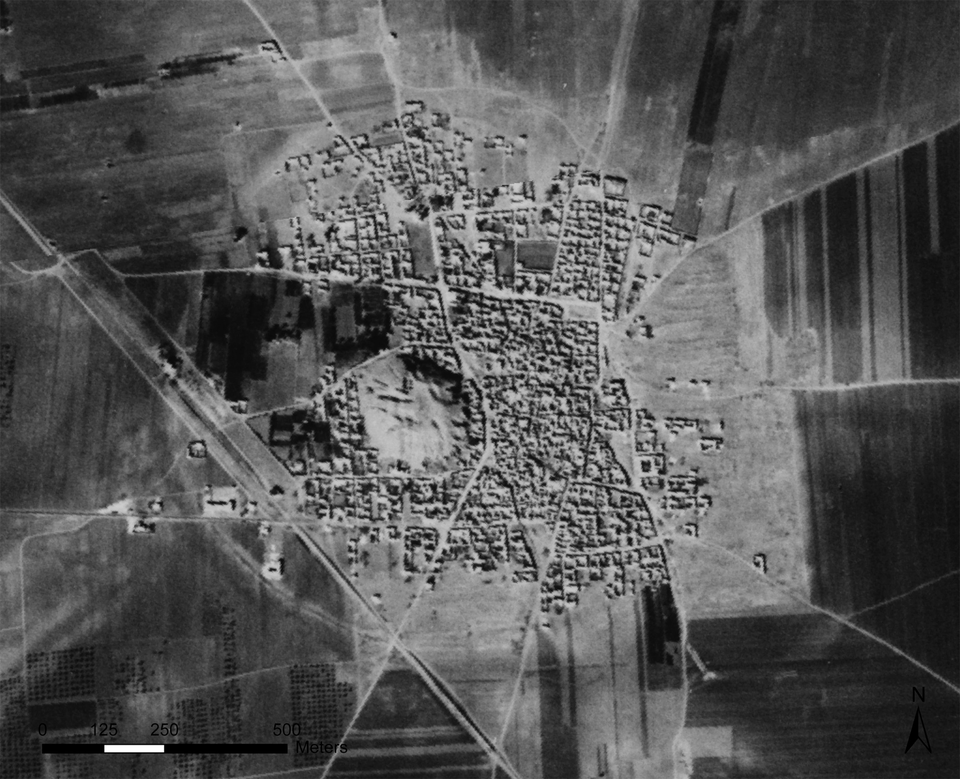
While Lidar provides unparalleled detail, high-resolution satellite imagery offers a broader, global perspective. Satellites orbiting Earth continuously capture images, allowing archaeologists to identify potential sites based on subtle patterns in vegetation, soil discoloration, or faint outlines of ancient infrastructure.
Case Study: The Amazon’s Geoglyphs and Mound Cities
For many years, the Amazon rainforest was considered a pristine, untouched wilderness prior to European arrival. However, satellite imagery, combined with subsequent Lidar surveys and ground truthing, has begun to reveal a different story: a landscape profoundly shaped by sophisticated ancient civilizations.
The ability to survey vast, inaccessible areas quickly and non-invasively means that the era of simply stumbling upon ancient civilizations is largely over. Now, archaeologists can strategically target their efforts, making every excavation count.

Beneath the Surface: Ground-Penetrating Radar and Magnetometry
While aerial technologies reveal the layout of hidden empires from above, other sophisticated tools allow archaeologists to peer beneath the earth’s surface without disturbing it. These geophysical survey methods are invaluable for identifying buried structures, walls, and even artifacts before a single shovel breaks ground.
Ground-Penetrating Radar (GPR): X-Ray Vision for the Earth
Ground-Penetrating Radar (GPR) works by sending electromagnetic pulses into the ground. When these pulses encounter different materials – such as stone walls, buried pits, or even changes in soil density – they reflect back to a receiver. By analyzing the timing and strength of these reflections, archaeologists can create detailed cross-sectional images of what lies beneath the surface, much like an X-ray.
Case Study: Uncovering Roman Cities and Villas
GPR has been particularly effective in Europe, where centuries of agricultural activity or later construction have often obscured Roman remains.
Magnetometry: Detecting Disturbances in the Earth’s Magnetic Field
Magnetometry measures minute variations in the earth’s magnetic field. Buried features, especially those related to human activity, often create magnetic anomalies. For example, fired clay (like bricks or pottery), hearths, iron objects, and even ditches or pits filled with different soil types can create detectable magnetic signatures.
Case Study: Neolithic Settlements and Iron Age Forts
Magnetometry is excellent for identifying sites where human activity has altered the soil composition or introduced magnetic materials.
These subsurface imaging techniques are transforming the initial stages of archaeological research, enabling archaeologists to be far more strategic and efficient. Imagine being able to “see” a buried city before ever putting a shovel in the ground – that’s the power of modern geophysics.
From the Deep: Underwater Archaeology and Submerged Worlds
The land isn’t the only place where hidden empires lie waiting to be discovered. The world’s oceans, lakes, and rivers hold untold secrets, preserving shipwrecks, ancient ports, and even entire cities that succumbed to rising sea levels or natural disasters. Underwater archaeology, once a perilous and limited endeavor, has been revolutionized by advanced sonar, remotely operated vehicles (ROVs), and sophisticated mapping technologies.
Sonar and Multibeam Echosounders: Mapping the Ocean Floor
Sonar (Sound Navigation and Ranging) uses sound waves to detect objects and map the seafloor. Multibeam echosounders, a more advanced form of sonar, can map vast areas of the seabed in high resolution, creating detailed 3D models of submerged landscapes. These tools are essential for identifying anomalies that could indicate shipwrecks or buried structures.
Case Study: Thonis-Heracleion, Egypt’s Lost City
For centuries, the ancient Egyptian city of Thonis-Heracleion was believed to be a myth, mentioned only in a few ancient texts. Located in the Bay of Aboukir near Alexandria, it was Egypt’s primary port on the Mediterranean before the founding of Alexandria.
ROVs and AUVs: Robotic Explorers of the Deep
Remotely Operated Vehicles (ROVs) and Autonomous Underwater Vehicles (AUVs) are game-changers for exploring dangerous or inaccessible underwater environments. Equipped with high-definition cameras, manipulators, and various sensors, these robotic explorers can conduct surveys, take samples, and document sites for extended periods without risking human divers.
Case Study: Pavlopetri, Greece – The World’s Oldest Submerged City
Off the coast of Laconia in southern Greece lies Pavlopetri, a Bronze Age city submerged by millennia of geological shifts and rising sea levels.
Underwater archaeological discoveries are not only thrilling but also critical for understanding human migration, trade routes, and the impact of environmental changes on ancient civilizations.
Decoding the Past: New Interpretations and Unwritten Histories
The impact of modern archaeology extends beyond merely finding new sites. It’s also fundamentally changing how we interpret existing ones and, in many cases, rewriting the very narratives of ancient civilizations. New technologies allow for a deeper, more nuanced understanding of settlement patterns, social structures, and cultural practices.
Revisiting Known Sites with New Eyes
Even iconic sites thought to be thoroughly understood are yielding new secrets thanks to advanced techniques. For instance, Lidar surveys around Stonehenge have revealed a vast complex of previously unknown henges, barrows, and enclosures, demonstrating that the famous stone circle was just one part of an enormous, interconnected ritual landscape. Similarly, GPR has uncovered more extensive Roman infrastructure beneath modern cities than previously imagined.
This isn’t just about adding new chapters to history; it’s about re-editing the entire book.
The Power of Data: Big Data and AI in Archaeology
The sheer volume of data generated by Lidar, GPR, and satellite imagery is immense. This “big data” can be analyzed using artificial intelligence (AI) and machine learning algorithms to identify subtle patterns that human eyes might miss. AI can help predict where new sites might be found based on environmental factors, historical records, and known site characteristics, making the search for hidden empires even more targeted.
Giving Voice to the Unwritten
Many ancient civilizations left no written records, or their records have been lost. For these cultures, archaeology is often the only window into their past. The precise mapping capabilities of modern archaeology allow for more detailed analysis of settlement layouts, agricultural systems, and defensive structures, providing critical clues about their social organization, population size, and technological prowess. This is especially true for pre-Columbian societies in the Americas or early farming communities in Europe, whose histories are being reconstructed brick by digital brick.
The Human Element: Collaboration and Community Engagement
While technology drives many of the exciting archaeological discoveries, the human element remains paramount. Modern archaeology increasingly emphasizes collaboration, not just among scientists but also with local communities and indigenous populations.
Ethical Considerations and Local Knowledge
The discovery of hidden empires often has profound implications for the people living near these sites today. Respect for cultural heritage, land rights, and local traditions is crucial. Modern archaeology strives for ethical engagement, ensuring that discoveries benefit and empower local communities.
The Role of Citizen Scientists
The accessibility of satellite imagery and the enthusiasm of history buffs have also led to the rise of citizen science in archaeology. Projects like GlobalXplorer, led by Sarah Parcak, encourage volunteers to review satellite images to identify potential archaeological sites, crowdsourcing the initial stage of discovery. This democratizes the search for ancient civilizations and engages a broader public in the thrill of discovery.
The Future of Discovery: AI, Robotics, and Beyond
The pace of innovation in modern archaeology shows no signs of slowing down. The future promises even more sophisticated tools that will continue to push the boundaries of what we can discover about hidden empires.
The next great archaeological discovery might not be found by a lone explorer, but by a team of scientists, equipped with an arsenal of digital tools, collaborating with local communities to unlock the earth’s deepest secrets.
Frequently Asked Questions About Modern Archaeological Discoveries
Q1: What is Lidar and how does it help find ancient civilizations?
Lidar (Light Detection and Ranging) uses laser pulses to create detailed 3D maps of the ground surface. It’s incredibly useful for archaeology because the laser pulses can penetrate dense vegetation, like jungle canopies, allowing archaeologists to “see through” the forest and identify human-made structures, roads, and agricultural features that have been reclaimed by nature. This has been revolutionary for finding hidden empires in places like the Maya lowlands.
Q2: How do archaeologists find underwater hidden empires?
Underwater archaeologists primarily use sonar and multibeam echosounders to map the seafloor and identify anomalies that could be shipwrecks or submerged structures. Once potential sites are located, they deploy Remotely Operated Vehicles (ROVs) or Autonomous Underwater Vehicles (AUVs) equipped with cameras and sensors for closer inspection and documentation, often followed by human divers for detailed excavation.
Q3: What is the biggest impact of modern archaeology on our understanding of ancient history?
The biggest impact is arguably the ability to revise population estimates and understand the true scale and complexity of ancient civilizations. Technologies like Lidar have revealed vast, interconnected urban and agricultural landscapes in areas previously thought to be sparsely populated, fundamentally changing our understanding of human ingenuity, environmental management, and social organization in hidden empires.
Q4: Can AI really help find new archaeological sites?
Yes, Artificial Intelligence (AI) and machine learning are increasingly used in archaeology. AI can analyze vast datasets from satellite imagery, Lidar, and historical maps to identify subtle patterns and predict areas with a high probability of containing undiscovered sites. This makes the search for archaeological discoveries much more targeted and efficient, moving towards “predictive archaeology.”
Q5: Are there ethical concerns with using advanced technology in archaeology?
Absolutely. While technology is powerful, archaeologists must always prioritize ethical considerations. This includes respecting cultural heritage, consulting with local and indigenous communities, ensuring discoveries lead to responsible preservation, and sharing benefits equitably. The goal is to illuminate ancient civilizations respectfully, not to exploit them.
Conclusion: The Unfolding Story of Humanity’s Past
The quest to understand our past is an unending journey, and modern archaeology is equipping us with an ever-more powerful compass. From the laser eyes of Lidar piercing jungle canopies to the sonar pulses mapping submerged cities, and the AI algorithms sifting through vast amounts of data, the tools at our disposal are transforming the field. We are no longer just digging; we are digitally stripping away the layers of time, revealing the intricate patterns of hidden empires and the remarkable ingenuity of ancient civilizations.
These archaeological discoveries are not just about finding old ruins; they are about rewriting our collective story, challenging long-held assumptions, and giving voice to cultures that were once thought lost forever. Every new find offers a fresh perspective on human adaptation, innovation, and resilience. The earth still holds countless secrets, but with each passing year, modern archaeology brings us closer to unveiling them, painting an ever-richer tapestry of humanity’s incredible journey.
Don’t miss out on the unfolding narrative of our ancestors! Explore hidden empires with our interactive timeline and journey through the most significant archaeological discoveries shaping our understanding of the ancient world.
—
Image Alt Text Suggestions:
Internal Link Suggestions (Anchor Text):
External Link Suggestions (Anchor Text – open in new window):
Schema Markup Recommendation:
json
{
  "@context": "https://schema.org",
  "@type": "Article",
  "headline": "Unveiling Hidden Empires: Modern Archaeology's Thrilling Discoveries of Ancient Civilizations",
  "description": "Explore how modern archaeology, with technologies like Lidar, GPR, and AI, is uncovering lost cities and rewriting the history of ancient civilizations.",
  "image": [
    "https://example.com/images/lidar-maya-city.jpg",
    "https://example.com/images/thonis-heracleion-statue.jpg",
    "https://example.com/images/pavlopetri-3d-map.jpg"
  ],
  "datePublished": "2023-10-27T08:00:00+08:00",
  "dateModified": "2023-10-27T09:00:00+08:00",
  "author": {
    "@type": "Person",
    "name": "Your Name/Organization Name"
  },
  "publisher": {
    "@type": "Organization",
    "name": "Your Website Name",
    "logo": {
      "@type": "ImageObject",
      "url": "https://example.com/images/logo.png"
    }
  },
  "mainEntityOfPage": {
    "@type": "WebPage",
    "@id": "https://example.com/blog/hidden-empires-modern-archaeology-discoveries"
  },
  "keywords": "hidden empires, archaeological discoveries, ancient civilizations, modern archaeology, lidar, GPR, underwater archaeology, AI in archaeology, lost cities, Maya civilization, Thonis-Heracleion, Pavlopetri"
}