
Hidden Empires: Unveiling Forgotten Civilizations Through Modern Archaeology
Imagine walking through a dense Central American jungle, your boots sinking into centuries of humus, when suddenly your machete clinks against something hard. You brush away the vines and there it is—a carved stone face staring back at you, the first glimpse of a city that hasn’t seen sunlight in a thousand years. That romantic image still happens, but today’s archaeologists are just as likely to make world-changing discoveries while sitting in a climate-controlled office, staring at a computer screen. Modern archaeology has entered a golden age where lasers pierce through jungle canopies, satellites map buried city grids from space, and ground-penetrating radar reveals hidden empires without turning a single spade of soil.
We tend to think of history as a mostly complete jigsaw puzzle, with just a few missing pieces around the edges. The truth is far more humbling—and exciting. For every well-known ancient civilization like Rome or Egypt, there are several others we’re only now beginning to uncover. Entire kingdoms, sprawling urban networks, and sophisticated cultures flourished for centuries before vanishing so completely that even their names were forgotten. These hidden empires are rewriting our understanding of human capability, pushing back the timeline of complex society and revealing that our ancestors were far more interconnected, innovative, and resilient than we ever imagined.
So how are we finding civilizations that left behind no written records, no towering monuments visible for miles, and sometimes no trace at all on the surface? The answer lies in a suite of technologies that sound like they belong in a spy thriller: LiDAR, multispectral satellite imaging, magnetometry, and even artificial intelligence. Coupled with old-fashioned intuition and the occasional lucky accident, these tools are peeling back the earth’s layers to expose the lost civilizations that have been hiding in plain sight—or right beneath our feet. Let’s journey through some of the most groundbreaking archaeological discoveries reshaping history, and meet the hidden empires that are finally stepping back into the light.

The Technology Time Machine: Tools That See Through Time
Before we dig into the civilizations themselves, let’s understand the tools that made these revelations possible. Traditional archaeology often relied on painstaking excavation—a process that can destroy as much as it preserves and is limited by time, funding, and sheer physical effort. Today’s archaeologists have become technological detectives, assembling clues without disturbing the ground. This isn’t just about convenience; it’s about preserving sites for future generations while still decoding their secrets.
LiDAR (Light Detection and Ranging) has arguably done more for discovering hidden empires than any other technology. By mounting lasers on drones or aircraft, researchers can shoot millions of light pulses per second at the ground. These pulses penetrate vegetation gaps, bounce back, and create a digital “bare earth” map so precise that individual building foundations, causeways, and even plough marks from ancient fields become visible. Forests that once hid entire cities are stripped away digitally, and what’s revealed can be staggering. The same principle applies underwater, where sonar mapping has turned the seafloor into an archaeological treasure trove.
Satellite imagery works at a larger scale. Using infrared and multispectral sensors, satellites can detect subtle differences in vegetation growth, soil composition, and thermal signatures that betray buried structures. A stone wall just below the surface might stress the plants above, making them appear slightly yellower in infrared—a clue invisible to the naked eye but glaringly obvious to an analyst in a lab thousands of miles away. Meanwhile, ground-penetrating radar (GPR) and magnetometry allow archaeologists to “x-ray” the subsurface, mapping walls, fire pits, and even individual rooms without digging.
The result? We’re now finding ancient civilizations faster than we can excavate them, building a backlog of sites that will keep researchers busy for generations. But more importantly, we’re discovering that some of the most sophisticated cultures in history operate on scales and levels of complexity that force us to rethink what “advanced” really means.

Göbekli Tepe: The Temple Builders Who Came Before Everything
If you had asked an archaeologist in the 1980s when complex religious architecture first appeared, they’d have pointed to the rise of agriculture and settled villages around 6500 BCE. Surely you needed farms, surplus grain, and a stable social hierarchy before anyone could organize the labor to erect monumental stone temples. Then a German archaeologist named Klaus Schmidt visited a hilltop in southeastern Turkey that locals had long dismissed as a medieval cemetery. What he found turned that assumption on its head.
Göbekli Tepe is not a single temple but a complex of circular enclosures, each ringed with massive T-shaped limestone pillars—some standing over 16 feet tall and weighing up to 20 tons. They’re carved with intricate reliefs of animals: scorpions, foxes, boars, vultures, snakes, and spiders. The artistry is breathtaking, but the real shock came when organic material from the site was radiocarbon-dated. The structures were built around 9500 BCE—over 11,000 years ago, a staggering 6,000 years before Stonehenge and long before anyone was supposed to have the ability or the motive to build something this elaborate.
This was a time when humans were still hunter-gatherers, living in small nomadic bands. There is no evidence of permanent homes, agriculture, or domesticated animals at Göbekli Tepe—only this monumental sanctuary, used for centuries and then deliberately buried. The sheer scale implies an organized society capable of feeding hundreds of workers and coordinating complex construction. Some archaeologists now believe that ritual gatherings here might have actually spurred the invention of agriculture, as people needed reliable food sources to sustain the building efforts. In other words, religion may have come first, and farming followed—a complete inversion of the old model.
Göbekli Tepe remains one of the most profound archaeological discoveries in history. And just when we thought we had a handle on it, surveys of the surrounding hills have revealed at least a dozen similar sites waiting to be explored. This wasn’t a one-off; it was a whole network of sacred places. The hidden empire of the hunter-gatherers is only beginning to emerge, and it’s fundamentally challenging what we mean by “civilization.”
The Amazon’s Garden Cities: A Rainforest Empire Erased by Nature
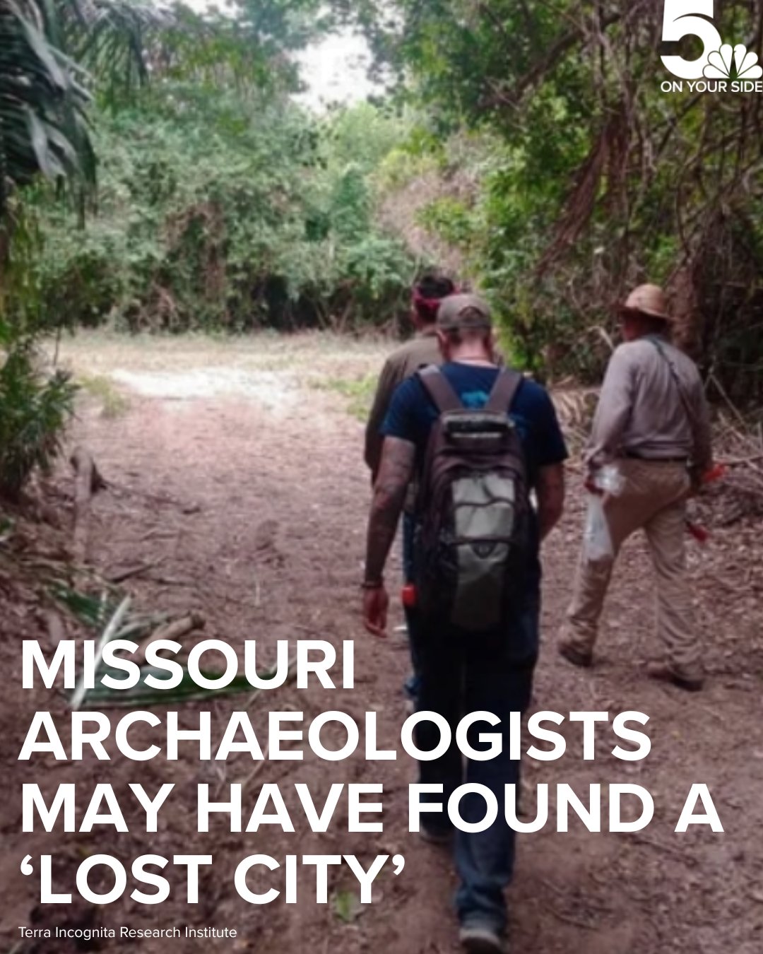
For centuries, explorers returned from the Amazon basin with tantalizing tales of sprawling cities and complex societies. Spanish conquistador Francisco de Orellana claimed to have seen dense settlements and enormous causeways along the river in the 1540s. But by the time later expeditions retraced his steps, they found only unbroken jungle. The accounts were dismissed as myths—after all, how could a great civilization thrive in the thin, nutrient-poor soils of the rainforest? The consensus hardened: the Amazon was a pristine wilderness, sparsely populated by small, simple tribes. It was a conclusion as wrong as it was enduring.
In recent decades, three things happened. First, archaeologists began noticing patches of incredibly fertile, dark soil—terra preta—scattered throughout the basin. This soil didn’t occur naturally; it was human-made, enriched with charcoal, bone, and organic waste over generations. Second, deforestation exposed vast geometric earthworks, including ditches, embankments, and raised causeways stretching for miles. Third, and most dramatically, LiDAR flew. When researchers scanned the understory of the Bolivian and Brazilian Amazon, the results were nothing short of a revelation. Beneath the trees lay the unmistakable outlines of monumental platforms, pyramidal mounds, sunken plazas, and connecting road networks that rivaled anything in medieval Europe.
One of the most stunning archaeological discoveries is the so-called “Garden Cities” of the Upper Xingu. Here, communities of up to 50,000 people lived in carefully planned settlements, managing the landscape in ways we’re only beginning to understand. They didn’t clear the forest so much as transform it, cultivating fruit and nut trees, channeling fish weirs, and maintaining the soil’s fertility through methods modern science still can’t fully replicate. The sites were linked by long causeways aligned with astronomical precision. These were lost civilizations in plain sight—their monumental earthworks dismissed as natural hills for centuries.
The implications are staggering. Before European diseases raced ahead of colonization, wiping out an estimated 90% of the indigenous population, the Amazon supported millions of people living in complex, interconnected societies. The “pristine wilderness” was actually a managed parkland, a hidden empire so vast and successful that its footprint can still be seen from space. Modern archaeology is not just finding artifacts; it’s restoring the dignity and history of cultures that were written out of the story.
The Kingdom of Aksum: Africa’s Forgotten Superpower
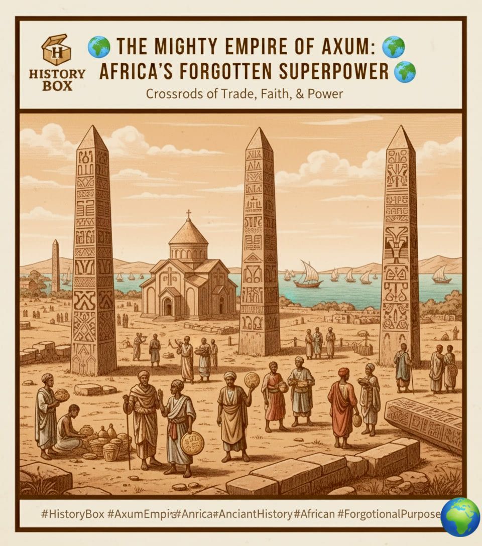
Ask most people to name the great empires of the ancient world, and you’ll hear Rome, Persia, China, maybe the Maya. Rarely does anyone mention Aksum, yet this African kingdom was once counted among the world’s four great powers alongside Rome, Persia, and China. At its height between the 1st and 7th centuries CE, Aksum controlled trade across the Red Sea, minted its own gold coins, and built monumental stelae—towering granite obelisks that still stand today in northern Ethiopia. One of the tallest, now fallen, would have been 108 feet high, making it the single largest monolithic stone ever quarried in the ancient world. And yet, Aksum is largely absent from popular history.
Modern archaeology is changing that. Ground-penetrating radar and magnetometry surveys in and around the city of Aksum have revealed a vast urban complex far larger than previously known. Elite residences with multiple rooms, sophisticated drainage systems, and evidence of long-distance trade from India to the Mediterranean are reshaping the narrative. Aksum wasn’t just a regional power; it was a cosmopolitan hub. The kingdom adopted Christianity in the 4th century, making it one of the first official Christian states, and its liturgical language, Ge’ez, is still used in Ethiopian churches today. Legend holds that the Ark of the Covenant resides in Aksum, and while archaeology can’t speak to that, it does confirm a uniquely rich cultural and religious tradition.
What makes Aksum so fascinating as one of the hidden empires is that it demonstrates how historical memory can be selectively erased. The reasons are complex: the rise of Islam shifted trade routes away from the Red Sea, the kingdom declined, and European colonial narratives often minimized African civilizations to justify exploitation. But the facts are stubborn things, and the ruins, inscriptions, and coins keep speaking. An underground network of tombs and tunnels, still being mapped, suggests a kingdom that invested heavily in commemoration and the afterlife. Aksum is a reminder that the story of human achievement is far more global and older than the textbooks suggest.

Angkor and the Khmer Empire: The Megacity in the Jungle
Angkor Wat is one of the most famous temples on Earth, a bucket-list destination for millions. But the temple is just the tip of the iceberg—literally. For decades, scholars understood that Angkor was a significant urban center, but the surrounding jungle was so impenetrable that the true scale remained a mystery. Then, in 2012 and 2015, LiDAR surveys of the entire Angkor region revealed an urban network of breathtaking complexity. The “temple forest” was hiding a full-blown megacity.
The ancient civilization of the Khmer, which peaked between the 9th and 15th centuries, constructed the largest pre-industrial city in human history. The LiDAR maps show a dense grid of roads, canals, residential blocks, and artificial reservoirs (barays) covering an area of more than 1,000 square kilometers—larger than modern-day Paris. The water management system alone was an engineering marvel, with channels, spillways, and storage basins designed to control the monsoon floods and irrigate rice paddies year-round. This intricate hydraulic network supported upwards of 750,000 people at a time when London was a muddy town of 30,000.
The collapse of Angkor has long been debated, and the new data provides fresh clues. The evidence points to a series of severe droughts interspersed with mega-monsoons that overwhelmed the water system. As the infrastructure failed, the urban core became unlivable, and power shifted southward toward Phnom Penh. But the Khmer didn’t simply vanish; they adapted, and their cultural legacy continues in modern Cambodia. The story of Angkor is a powerful example of how modern archaeology can turn a well-known site into an entirely new discovery. What we thought was a religious complex with some surrounding villages was actually a sprawling metropolis whose sophistication rivals any contemporary city in Europe or Asia.
The Indus Valley Civilization: A Peaceful Empire Without Kings?
Stretching across modern Pakistan and northwest India, the Indus Valley Civilization (also known as the Harappan civilization) was the largest of the ancient Old World cultures, covering an area larger than ancient Egypt and Mesopotamia combined. At its peak around 2500 BCE, it boasted planned cities like Mohenjo-daro and Harappa with grid-like streets, advanced drainage systems, and standardized brick sizes that suggest incredible organizational skills. And yet, we know less about the Indus people than almost any other major ancient civilization. Why? Their script remains undeciphered.
The Indus script, found on small seals and tablets, uses around 400 distinct symbols. Despite decades of effort and the application of computer algorithms and AI, it has resisted translation because the “texts” are frustratingly short—most are just four or five symbols. But modern archaeology is filling in the blanks through careful excavation and the use of satellite imagery to locate new sites. There are now over 1,400 known Indus settlements, many identified through remote sensing in the Cholistan Desert and the now-dry bed of the Ghaggar-Hakra River.
One of the most intriguing aspects of the Indus Valley people is what they seem to lack: there’s no clear evidence of palaces, massive tombs, or royal iconography. No kingly monuments, no obvious hierarchical worship. Instead, we see a remarkable uniformity in pottery, weights, and measures, suggesting a highly integrated and possibly egalitarian society. Some archaeologists propose that the Indus state was built on trade and craft specialization rather than conquest. They navigated long-distance trade with Mesopotamia, exporting carnelian beads, cotton, and timber. The so-called “Priest-King” statue found at Mohenjo-daro might actually depict a priest or an ancestor figure, not a ruler.
Climate change appears to have been the culprit in the civilization’s decline, as shifts in monsoon patterns made agriculture unreliable. The population didn’t so much vanish as disperse, blending into the surrounding countryside and contributing to the genetic and cultural mix that would later give rise to classical Indian civilization. The Indus Valley is a masterclass in how a huge, influential hidden empire can be right under our noses—amazingly, many of its ruined cities were first discovered only in the 1920s, and we’re still adding new ones each year. It’s a humbling reminder that a civilization can be vast, accomplished, and yet utterly forgotten until science lends a hand.
Underwater Ghosts: The Lost Cities Beneath the Waves
Not all hidden empires lie beneath soil and jungle. Some are submerged, swallowed by rising seas, tsunamis, or tectonic shifts. The Mediterranean alone is a graveyard of ancient port cities, but perhaps the most dramatic recent archaeological discoveries have come from the coast of Egypt. The legendary city of Heracleion (known in Egyptian as Thonis) was a thriving gateway between Egypt and the Greek world, mentioned in classical texts but considered myth until the year 2000. That’s when underwater archaeologist Franck Goddio and his team, using advanced sonar and magnetometry, found statues, temples, and shipwrecks just a few kilometers off the coast of Alexandria, under 30 feet of water.
What emerged was a full-scale port city, complete with a huge temple to Amun, colossal statues of pharaohs and gods, hundreds of anchors, and a fleet of ancient ships. Heracleion sank gradually beginning around the 2nd century BCE, likely due to soil liquefaction and a rising sea level. The silt and water preserved organic materials rarely found on land, including wooden furnishings, fruit baskets, and papyrus scrolls. The finds have transformed our understanding of trade and religion in the late Pharaonic era, showing a fusion of Egyptian and Greek cultures long before Alexander the Great.
Similarly, on Israel’s coast, the submerged Neolithic village of Atlit-Yam dates back over 9,000 years, with stone houses, wells, and even a ritual stone circle. Human skeletons show signs of tuberculosis—some of the earliest known cases—and the intact burials provide a time capsule of prehistoric life. As sea levels continue to rise, archaeologists are racing to document these submerged lost civilizations, pioneering techniques like 3D photogrammetry that create stunningly accurate digital models for study and public display.
How You Can Explore These Hidden Empires Today
The beauty of modern archaeology is that it’s not locked away in ivory towers. Many of the technologies used are publicly accessible. Satellite imagery programs like Google Earth have been instrumental in discovery—one archaeologist even found a previously unknown pyramid complex in Egypt from her living room sofa. Museums and universities increasingly offer online databases, virtual reality tours, and digitized excavation finds. The interactive tools that once only specialists used are trickling down to curious armchair explorers.
But nothing beats seeing the story unfold as new data comes in. That’s why we’ve created an immersive digital experience that lets you walk through these reborn cities, compare before-and-after LiDAR scans, and trace the spread of trade routes across continents and millennia. Imagine standing at the edge of a virtual Göbekli Tepe enclosure, toggling between the overgrown hill and the reconstructed pillars, then jumping to the Amazon to watch the jungle melt away and reveal the causeways beneath.
History isn’t static—it’s being rewritten every year, sometimes every week. The hidden empires we’ve discussed are just a handful of the civilizations emerging from the shadows, and there are hundreds more waiting. A buried fortress in the Mongolian steppe was only identified in 2023; a massive ancient city in the oases of Saudi Arabia is still being mapped. The next chapter could be yours to witness firsthand.
Explore the secrets of hidden empires with our interactive timeline—zoom through 12,000 years of discovery, watch civilizations rise and fade, and see exactly where the latest digs are happening today. It’s the closest you can get to time travel without a DeLorean. And who knows? Maybe one of these maps will spark a question that leads you to the next big find. After all, in archaeology, the most thrilling words aren’t “Eureka!” but “What’s that over there?”
The ground beneath our feet is a library of lost worlds. Thanks to modern archaeology, the books are finally being opened. Which hidden empire will you discover tomorrow?